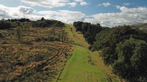
Antonine Wall, Bar Hill, rampart, ditch, fort and Military Way الإنجليزية (Q5615398)
part of the Antonine Wall in Scotland الإنجليزية
| اللغة | التسمية | الوصف | أسماء أخرى |
|---|---|---|---|
| العربية | لم تُضف التسمية |
لا يوجد وصف |
|
| الإنجليزية | Antonine Wall, Bar Hill, rampart, ditch, fort and Military Way |
part of the Antonine Wall in Scotland |
بيانات
Wikidata item الإنجليزية
OS grid reference الإنجليزية
Kirkintilloch الإنجليزية
object has role الإنجليزية
Scottish civil parish الإنجليزية
١ مراجع
Imported from Wikidata item الإنجليزية
coordinate location الإنجليزية
55°57'33.912"N, 4°4'26.875"W
OS grid reference الإنجليزية
NS 70610 75988
applies to part الإنجليزية
westernmost point on linear feature الإنجليزية
١ مراجع
Imported from Wikidata item الإنجليزية
55°57'41.422"N, 4°3'48.172"W
OS grid reference الإنجليزية
NS 71288 76200
applies to part الإنجليزية
easternmost point on linear feature الإنجليزية
١ مراجع
Imported from Wikidata item الإنجليزية
instance of الإنجليزية
country الإنجليزية
image الإنجليزية
Antoninus Wall near Bar Hill.jpg
٤٬٠٠٠ × ٢٬٢٥٠؛ ٥٫٨٣ ميجابايت
٤٬٠٠٠ × ٢٬٢٥٠؛ ٥٫٨٣ ميجابايت
١ مراجع
Imported from Wikidata item الإنجليزية
part of الإنجليزية
has part(s) الإنجليزية
length الإنجليزية
historic county الإنجليزية
heritage designation الإنجليزية
inventory number الإنجليزية
SM90008
start time الإنجليزية
٢ مارس 1961http://data.marefa.org/entity/Q1985727
١ مراجع
Imported from Wikidata item الإنجليزية
