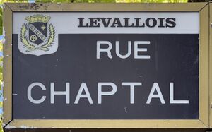
rue Chaptal الإنجليزية (Q1872058)
thoroughfare in Levallois-Perret, France الإنجليزية
| اللغة | التسمية | الوصف | أسماء أخرى |
|---|---|---|---|
| العربية | لم تُضف التسمية |
لا يوجد وصف |
|
| الإنجليزية | rue Chaptal |
thoroughfare in Levallois-Perret, France |
بيانات
Wikidata item الإنجليزية
country الإنجليزية
instance of الإنجليزية
named after الإنجليزية
Commons category الإنجليزية
coordinate location الإنجليزية
Google Knowledge Graph ID الإنجليزية
part of الإنجليزية
OpenStreetMap relation ID الإنجليزية
shares border with الإنجليزية
Rue Paul-Vaillant-Couturier الإنجليزية
coordinate location الإنجليزية
48°53'37.936"N, 2°16'41.516"E
١ مراجع
Imported from Wikidata item الإنجليزية
rue Jacques Ibert الإنجليزية
coordinate location الإنجليزية
48°53'12.264"N, 2°17'10.014"E
١ مراجع
Imported from Wikidata item الإنجليزية
Rue Voltaire الإنجليزية
coordinate location الإنجليزية
48°53'26.912"N, 2°16'52.172"E
١ مراجع
Imported from Wikidata item الإنجليزية
Rue Marceau الإنجليزية
coordinate location الإنجليزية
48°53'17.664"N, 2°17'3.462"E
١ مراجع
Imported from Wikidata item الإنجليزية
rue Louis-Rouquier الإنجليزية
coordinate location الإنجليزية
48°53'20.857"N, 2°16'59.563"E
١ مراجع
Imported from Wikidata item الإنجليزية
Rue Kléber الإنجليزية
coordinate location الإنجليزية
48°53'33.083"N, 2°16'46.157"E
١ مراجع
Imported from Wikidata item الإنجليزية
villa Chaptal الإنجليزية
coordinate location الإنجليزية
48°53'28.655"N, 2°16'50.484"E
١ مراجع
Imported from Wikidata item الإنجليزية
rue Aspirant Dargent الإنجليزية
coordinate location الإنجليزية
48°53'29.620"N, 2°16'49.469"E
١ مراجع
Imported from Wikidata item الإنجليزية
rue Barbès الإنجليزية
coordinate location الإنجليزية
48°53'25.148"N, 2°16'54.325"E
١ مراجع
Imported from Wikidata item الإنجليزية
Rue Aristide-Briand الإنجليزية
coordinate location الإنجليزية
48°53'23.413"N, 2°16'56.446"E
١ مراجع
Imported from Wikidata item الإنجليزية
rue Jacques-Ibert الإنجليزية
coordinate location الإنجليزية
48°53'12.264"N, 2°17'10.014"E
١ مراجع
Imported from Wikidata item الإنجليزية
pronunciation audio الإنجليزية
LL-Q150 (fra)-Hatokun24-rue Chaptal.wav
١٫٣ث؛ ٢٤٦ كيلوبايت
١٫٣ث؛ ٢٤٦ كيلوبايت
language of work or name الإنجليزية
١ مراجع
Imported from Wikidata item الإنجليزية
place name sign الإنجليزية
Plaque Rue Chaptal - Levallois-Perret (FR92) - 2023-07-06 - 1.jpg
٣٬٢٤٩ × ٢٬٠٢١؛ ١٫٣٦ ميجابايت
٣٬٢٤٩ × ٢٬٠٢١؛ ١٫٣٦ ميجابايت
١ مراجع
Imported from Wikidata item الإنجليزية
image الإنجليزية
Rue Chaptal - Levallois-Perret (FR92) - 2023-07-06 - 1.jpg
٤٬٠٣٢ × ٣٬٠٢٤؛ ٣٫٦٥ ميجابايت
٤٬٠٣٢ × ٣٬٠٢٤؛ ٣٫٦٥ ميجابايت
١ مراجع
Imported from Wikidata item الإنجليزية

