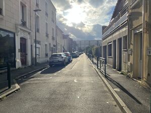
rue du Progrès الإنجليزية (Q2610673)
شارع في بينيو، فرنسا
| اللغة | التسمية | الوصف | أسماء أخرى |
|---|---|---|---|
| العربية | لم تُضف التسمية |
شارع في بينيو، فرنسا |
|
| الإنجليزية | rue du Progrès |
street in Bagneux, dans les Hauts-de-Seine |
بيانات
Wikidata item الإنجليزية
instance of الإنجليزية
country الإنجليزية
OpenStreetMap relation ID الإنجليزية
part of الإنجليزية
coordinate location الإنجليزية
named after الإنجليزية
shares border with الإنجليزية
avenue Aristide-Briand الإنجليزية
coordinate location الإنجليزية
48°47'57.149"N, 2°19'22.613"E
١ مراجع
Imported from Wikidata item الإنجليزية
rue de Verrieres الإنجليزية
coordinate location الإنجليزية
48°47'58.121"N, 2°19'16.360"E
١ مراجع
Imported from Wikidata item الإنجليزية
rue Andre Ox الإنجليزية
coordinate location الإنجليزية
48°47'58.121"N, 2°19'16.360"E
١ مراجع
Imported from Wikidata item الإنجليزية
Commons category الإنجليزية
image الإنجليزية
Rue Progrès - Bagneux (FR92) - 2023-08-01 - 1.jpg
٤٬٠٣٢ × ٣٬٠٢٤؛ ٤٫٦٨ ميجابايت
٤٬٠٣٢ × ٣٬٠٢٤؛ ٤٫٦٨ ميجابايت
١ مراجع
Imported from Wikidata item الإنجليزية
place name sign الإنجليزية
Plaque Rue Progrès - Bagneux (FR92) - 2023-08-01 - 1.jpg
٣٬٢٨٣ × ١٬٨٨١؛ ١٫٤ ميجابايت
٣٬٢٨٣ × ١٬٨٨١؛ ١٫٤ ميجابايت
١ مراجع
Imported from Wikidata item الإنجليزية

