ساوث كنزنغتون (Q321534)
area in the Royal Borough of Kensington and Chelsea and partly in the City of Westminster, London, England الإنجليزية
| اللغة | التسمية | الوصف | أسماء أخرى |
|---|---|---|---|
| العربية | ساوث كنزنغتون |
لا يوجد وصف |
|
| الإنجليزية | South Kensington |
area in the Royal Borough of Kensington and Chelsea and partly in the City of Westminster, London, England |
بيانات
Wikidata item الإنجليزية
country الإنجليزية
coordinate location الإنجليزية
OS grid reference الإنجليزية
Freebase ID الإنجليزية
instance of الإنجليزية
postal code الإنجليزية
VIAF ID الإنجليزية
topic's main category الإنجليزية
official website الإنجليزية
category for people born here الإنجليزية
category of associated people الإنجليزية
Commons category الإنجليزية
significant event الإنجليزية
historic county الإنجليزية
local dialing code الإنجليزية
different from الإنجليزية
shares border with الإنجليزية
native label الإنجليزية
image الإنجليزية
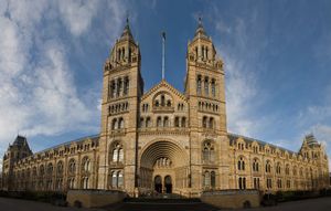
Natural History Museum London Jan 2006.jpg
٣٬٧٥٢ × ٢٬٣٩١؛ ٢٫٦٧ ميجابايت
٣٬٧٥٢ × ٢٬٣٩١؛ ٢٫٦٧ ميجابايت
١ مراجع
Imported from Wikidata item الإنجليزية
وصلات الموقع
Marefa(٠ : لا وصلات)
ويكيبيديا(٨ وصلات)
- cawiki South Kensington
- dewiki South Kensington
- enwiki South Kensington
- eswiki South Kensington
- fawiki کنزینگتون جنوبی
- frwiki South Kensington
- hewiki דרום קנזינגטון
- trwiki South Kensington
