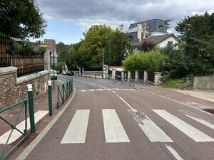
chemin Desvallières الإنجليزية (Q4713163)
way in Ville-d'Avray, France الإنجليزية
| اللغة | التسمية | الوصف | أسماء أخرى |
|---|---|---|---|
| العربية | لم تُضف التسمية |
لا يوجد وصف |
|
| الإنجليزية | chemin Desvallières |
way in Ville-d'Avray, France |
بيانات
Wikidata item الإنجليزية
instance of الإنجليزية
country الإنجليزية
OpenStreetMap relation ID الإنجليزية
part of الإنجليزية
coordinate location الإنجليزية
Commons category الإنجليزية
shares border with الإنجليزية
rue de la Ronce الإنجليزية
coordinate location الإنجليزية
48°49'26.540"N, 2°11'50.572"E
١ مراجع
Imported from Wikidata item الإنجليزية
avenue Gambetta الإنجليزية
coordinate location الإنجليزية
48°49'33.640"N, 2°11'53.538"E
١ مراجع
Imported from Wikidata item الإنجليزية
Rue de Ville-d'Avray (Sèvres) الإنجليزية
coordinate location الإنجليزية
48°49'33.640"N, 2°11'53.538"E
١ مراجع
Imported from Wikidata item الإنجليزية
avenue Gambetta الإنجليزية
coordinate location الإنجليزية
48°49'33.640"N, 2°11'53.538"E
١ مراجع
Imported from Wikidata item الإنجليزية
rue de Sèvres الإنجليزية
coordinate location الإنجليزية
48°49'33.640"N, 2°11'53.538"E
١ مراجع
Imported from Wikidata item الإنجليزية
chemin des Lutins الإنجليزية
coordinate location الإنجليزية
48°49'23.279"N, 2°11'45.679"E
١ مراجع
Imported from Wikidata item الإنجليزية
sentier des Lilas الإنجليزية
coordinate location الإنجليزية
48°49'29.662"N, 2°11'52.354"E
١ مراجع
Imported from Wikidata item الإنجليزية
chemin des Closeaux الإنجليزية
coordinate location الإنجليزية
48°49'27.037"N, 2°11'51.216"E
١ مراجع
Imported from Wikidata item الإنجليزية
place name sign الإنجليزية
Plaque Chemin Desvallières - Ville-d'Avray (FR92) - 2023-08-26 - 1.jpg
٣٬٣٨٣ × ١٬٩٥٨؛ ١٫٦ ميجابايت
٣٬٣٨٣ × ١٬٩٥٨؛ ١٫٦ ميجابايت
١ مراجع
Imported from Wikidata item الإنجليزية
image الإنجليزية
Chemin Desvallières - Ville-d'Avray (FR92) - 2023-08-26 - 1.jpg
٤٬٠٣٢ × ٣٬٠٢٤؛ ٤٫٥٤ ميجابايت
٤٬٠٣٢ × ٣٬٠٢٤؛ ٤٫٥٤ ميجابايت
١ مراجع
Imported from Wikidata item الإنجليزية

