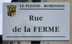
rue de la Ferme الإنجليزية (Q4739415)
street in Le Plessis-Robinson, France الإنجليزية
| اللغة | التسمية | الوصف | أسماء أخرى |
|---|---|---|---|
| العربية | لم تُضف التسمية |
لا يوجد وصف |
|
| الإنجليزية | rue de la Ferme |
street in Le Plessis-Robinson, France |
بيانات
Wikidata item الإنجليزية
instance of الإنجليزية
country الإنجليزية
OpenStreetMap relation ID الإنجليزية
part of الإنجليزية
coordinate location الإنجليزية
Commons category الإنجليزية
place name sign الإنجليزية
Plaque Rue Ferme - Le Plessis-Robinson (FR92) - 2021-01-03 - 1.jpg
٣٬١٣٨ × ١٬٩٣٧؛ ٣٫٨٤ ميجابايت
٣٬١٣٨ × ١٬٩٣٧؛ ٣٫٨٤ ميجابايت
١ مراجع
Imported from Wikidata item الإنجليزية
shares border with الإنجليزية
chemin des Guinguettes الإنجليزية
coordinate location الإنجليزية
48°46'51.463"N, 2°15'36.788"E
١ مراجع
Imported from Wikidata item الإنجليزية
avenue Aristide Briand الإنجليزية
coordinate location الإنجليزية
48°46'47.388"N, 2°15'35.608"E
١ مراجع
Imported from Wikidata item الإنجليزية
rue de la Mairie الإنجليزية
coordinate location الإنجليزية
48°46'56.615"N, 2°15'39.611"E
١ مراجع
Imported from Wikidata item الإنجليزية
rue de l'Orangerie الإنجليزية
coordinate location الإنجليزية
48°46'54.214"N, 2°15'38.592"E
١ مراجع
Imported from Wikidata item الإنجليزية
avenue du Général Leclerc الإنجليزية
coordinate location الإنجليزية
48°46'56.993"N, 2°15'39.542"E
١ مراجع
Imported from Wikidata item الإنجليزية
rue du Pot qui Mousse الإنجليزية
coordinate location الإنجليزية
48°46'49.609"N, 2°15'36.058"E
١ مراجع
Imported from Wikidata item الإنجليزية
image الإنجليزية
Rue Ferme - Le Plessis-Robinson (FR92) - 2023-08-14 - 1.jpg
٤٬٠٣٢ × ٣٬٠٢٤؛ ٣٫٩٥ ميجابايت
٤٬٠٣٢ × ٣٬٠٢٤؛ ٣٫٩٥ ميجابايت
١ مراجع
Imported from Wikidata item الإنجليزية

