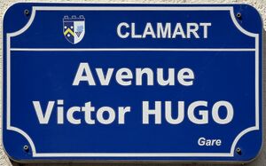
avenue Victor-Hugo (Clamart) الإنجليزية (Q4773019)
avenue in Clamart, France الإنجليزية
| اللغة | التسمية | الوصف | أسماء أخرى |
|---|---|---|---|
| العربية | لم تُضف التسمية |
لا يوجد وصف |
|
| الإنجليزية | avenue Victor-Hugo (Clamart) |
avenue in Clamart, France |
بيانات
Wikidata item الإنجليزية
instance of الإنجليزية
country الإنجليزية
named after الإنجليزية
Commons category الإنجليزية
part of الإنجليزية
OpenStreetMap relation ID الإنجليزية
coordinate location الإنجليزية
shares border with الإنجليزية
boulevard des Frères Vigouroux الإنجليزية
coordinate location الإنجليزية
48°48'45.504"N, 2°16'22.602"E
١ مراجع
Imported from Wikidata item الإنجليزية
rue Hébert الإنجليزية
coordinate location الإنجليزية
48°48'45.504"N, 2°16'22.602"E
١ مراجع
Imported from Wikidata item الإنجليزية
rue de Vanves الإنجليزية
coordinate location الإنجليزية
48°48'45.504"N, 2°16'22.602"E
١ مراجع
Imported from Wikidata item الإنجليزية
rue Pierre Baudry الإنجليزية
coordinate location الإنجليزية
48°48'40.655"N, 2°16'21.108"E
١ مراجع
Imported from Wikidata item الإنجليزية
villa des Closiaux الإنجليزية
coordinate location الإنجليزية
48°48'28.372"N, 2°16'15.323"E
١ مراجع
Imported from Wikidata item الإنجليزية
rue Louis Guespin الإنجليزية
coordinate location الإنجليزية
48°48'19.174"N, 2°16'6.607"E
١ مراجع
Imported from Wikidata item الإنجليزية
Rue Paul-Vaillant-Couturier (Clamart) الإنجليزية
coordinate location الإنجليزية
48°48'6.599"N, 2°15'56.513"E
١ مراجع
Imported from Wikidata item الإنجليزية
rue Pierre et Marie Curie الإنجليزية
coordinate location الإنجليزية
48°48'6.599"N, 2°15'56.513"E
١ مراجع
Imported from Wikidata item الإنجليزية
rue Lazare Carnot الإنجليزية
coordinate location الإنجليزية
48°48'33.678"N, 2°16'18.768"E
١ مراجع
Imported from Wikidata item الإنجليزية
rue Paul Bert الإنجليزية
coordinate location الإنجليزية
48°48'28.192"N, 2°16'15.200"E
١ مراجع
Imported from Wikidata item الإنجليزية
rue Gabriel Péri الإنجليزية
coordinate location الإنجليزية
48°48'12.701"N, 2°16'0.347"E
١ مراجع
Imported from Wikidata item الإنجليزية
cité Victor Hugo الإنجليزية
coordinate location الإنجليزية
48°48'35.647"N, 2°16'19.463"E
١ مراجع
Imported from Wikidata item الإنجليزية
allée Antoine Grossin الإنجليزية
coordinate location الإنجليزية
48°48'43.862"N, 2°16'22.015"E
١ مراجع
Imported from Wikidata item الإنجليزية
coteau des Vignes الإنجليزية
coordinate location الإنجليزية
48°48'39.499"N, 2°16'20.744"E
١ مراجع
Imported from Wikidata item الإنجليزية
rue Parmentier الإنجليزية
coordinate location الإنجليزية
48°48'37.462"N, 2°16'20.014"E
١ مراجع
Imported from Wikidata item الإنجليزية
rue Jules Ferry الإنجليزية
coordinate location الإنجليزية
48°48'31.162"N, 2°16'17.202"E
١ مراجع
Imported from Wikidata item الإنجليزية
allée Victor Hugo الإنجليزية
coordinate location الإنجليزية
48°48'31.162"N, 2°16'17.202"E
١ مراجع
Imported from Wikidata item الإنجليزية
rue Pierre Louvrier الإنجليزية
coordinate location الإنجليزية
48°48'22.126"N, 2°16'9.354"E
١ مراجع
Imported from Wikidata item الإنجليزية
rue Louis Dupont الإنجليزية
coordinate location الإنجليزية
48°48'13.370"N, 2°16'0.660"E
١ مراجع
Imported from Wikidata item الإنجليزية
place name sign الإنجليزية
Plaque Avenue Victor Hugo - Clamart (FR92) - 2023-08-20 - 1.jpg
٣٬٥٨٦ × ٢٬٢٣٩؛ ١٫٨٨ ميجابايت
٣٬٥٨٦ × ٢٬٢٣٩؛ ١٫٨٨ ميجابايت
١ مراجع
Imported from Wikidata item الإنجليزية
image الإنجليزية
Avenue Victor Hugo - Clamart (FR92) - 2023-08-20 - 1.jpg
٤٬٠٣٢ × ٣٬٠٢٤؛ ٤٫٣٥ ميجابايت
٤٬٠٣٢ × ٣٬٠٢٤؛ ٤٫٣٥ ميجابايت
١ مراجع
Imported from Wikidata item الإنجليزية

