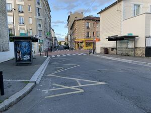
impasse Desgranges الإنجليزية (Q5170391)
street of Montreuil, Seine-Saint-Denis, France الإنجليزية
| اللغة | التسمية | الوصف | أسماء أخرى |
|---|---|---|---|
| العربية | لم تُضف التسمية |
لا يوجد وصف |
|
| الإنجليزية | impasse Desgranges |
street of Montreuil, Seine-Saint-Denis, France |
بيانات
Wikidata item الإنجليزية
country الإنجليزية
instance of الإنجليزية
coordinate location الإنجليزية
OpenStreetMap relation ID الإنجليزية
Commons category الإنجليزية
place name sign الإنجليزية
Plaque Rue Desgranges - Montreuil (FR93) - 2020-10-21 - 2.jpg
٣٬٠٦٦ × ٢٬١٤٧؛ ١٫٨٧ ميجابايت
٣٬٠٦٦ × ٢٬١٤٧؛ ١٫٨٧ ميجابايت
١ مراجع
Imported from Wikidata item الإنجليزية
image الإنجليزية
Rue Desgranges - Montreuil (FR93) - 2020-10-21 - 2.jpg
٤٬٠٣٢ × ٣٬٠٢٤؛ ٤٫٢٦ ميجابايت
٤٬٠٣٢ × ٣٬٠٢٤؛ ٤٫٢٦ ميجابايت
١ مراجع
Imported from Wikidata item الإنجليزية
part of الإنجليزية
nighttime view الإنجليزية
Rue Desgranges - Montreuil (FR93) - 2022-02-08 - 1.jpg
٤٬٠٣٢ × ٣٬٠٢٤؛ ٣٫٩٨ ميجابايت
٤٬٠٣٢ × ٣٬٠٢٤؛ ٣٫٩٨ ميجابايت
١ مراجع
Imported from Wikidata item الإنجليزية
shares border with الإنجليزية
Rue de Verdun الإنجليزية
coordinate location الإنجليزية
48°51'9.241"N, 2°26'35.855"E
١ مراجع
Imported from Wikidata item الإنجليزية
Rue Victor-Mercier الإنجليزية
coordinate location الإنجليزية
48°51'9.241"N, 2°26'35.855"E
١ مراجع
Imported from Wikidata item الإنجليزية
Rue Joseph-Gaillard الإنجليزية
coordinate location الإنجليزية
48°51'9.241"N, 2°26'35.855"E
١ مراجع
Imported from Wikidata item الإنجليزية
Rue des Trois-Territoires الإنجليزية
coordinate location الإنجليزية
48°51'6.440"N, 2°26'34.998"E
١ مراجع
Imported from Wikidata item الإنجليزية
Rue de la Solidarité الإنجليزية
coordinate location الإنجليزية
48°51'10.300"N, 2°26'36.276"E
١ مراجع
Imported from Wikidata item الإنجليزية
rue du Levant الإنجليزية
coordinate location الإنجليزية
48°51'12.132"N, 2°26'37.230"E
١ مراجع
Imported from Wikidata item الإنجليزية
Rue Merlet الإنجليزية
coordinate location الإنجليزية
48°51'12.676"N, 2°26'37.550"E
١ مراجع
Imported from Wikidata item الإنجليزية
Rue Colmet-Lépinay الإنجليزية
coordinate location الإنجليزية
48°51'15.865"N, 2°26'39.415"E
١ مراجع
Imported from Wikidata item الإنجليزية
Rue Charles-Silvestri الإنجليزية
coordinate location الإنجليزية
48°51'6.440"N, 2°26'34.998"E
١ مراجع
Imported from Wikidata item الإنجليزية
Rue des Trois-Territoires الإنجليزية
coordinate location الإنجليزية
48°51'6.440"N, 2°26'34.998"E
١ مراجع
Imported from Wikidata item الإنجليزية
Rue Joseph-Gaillard الإنجليزية
coordinate location الإنجليزية
48°51'9.241"N, 2°26'35.855"E
١ مراجع
Imported from Wikidata item الإنجليزية


