Rue de la Gare (Châtillon) الإنجليزية (Q5262913)
شارع في فرنسا
| اللغة | التسمية | الوصف | أسماء أخرى |
|---|---|---|---|
| العربية | لم تُضف التسمية |
شارع في فرنسا |
|
| الإنجليزية | Rue de la Gare (Châtillon) |
street Châtillon, Hauts-de-Seine, France |
بيانات
Wikidata item الإنجليزية
instance of الإنجليزية
country الإنجليزية
Commons category الإنجليزية
coordinate location الإنجليزية
part of الإنجليزية
OpenStreetMap relation ID الإنجليزية
shares border with الإنجليزية
rue Pierre Semard الإنجليزية
coordinate location الإنجليزية
48°48'9.014"N, 2°17'28.784"E
١ مراجع
Imported from Wikidata item الإنجليزية
boulevard de la Liberté (Châtillon) الإنجليزية
coordinate location الإنجليزية
48°48'9.014"N, 2°17'28.784"E
١ مراجع
Imported from Wikidata item الإنجليزية
allée des Sarments الإنجليزية
coordinate location الإنجليزية
48°48'3.391"N, 2°17'25.091"E
١ مراجع
Imported from Wikidata item الإنجليزية
rue de Bagneux (Châtillon) الإنجليزية
coordinate location الإنجليزية
48°48'0.457"N, 2°17'22.207"E
١ مراجع
Imported from Wikidata item الإنجليزية
rue de la Mairie (Châtillon) الإنجليزية
coordinate location الإنجليزية
48°48'0.457"N, 2°17'22.207"E
١ مراجع
Imported from Wikidata item الإنجليزية
allée de la Fontaine الإنجليزية
coordinate location الإنجليزية
48°48'4.626"N, 2°17'26.002"E
١ مراجع
Imported from Wikidata item الإنجليزية
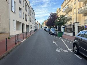
image الإنجليزية
Rue Gare - Châtillon (FR92) - 2023-08-15 - 1.jpg
٤٬٠٣٢ × ٣٬٠٢٤؛ ٣٫٠١ ميجابايت
٤٬٠٣٢ × ٣٬٠٢٤؛ ٣٫٠١ ميجابايت
١ مراجع
Imported from Wikidata item الإنجليزية
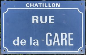
place name sign الإنجليزية
Plaque Rue Gare - Châtillon (FR92) - 2023-08-15 - 1.jpg
٣٬٤٧٨ × ٢٬٢٣٠؛ ١٫٤٥ ميجابايت
٣٬٤٧٨ × ٢٬٢٣٠؛ ١٫٤٥ ميجابايت
١ مراجع
Imported from Wikidata item الإنجليزية

