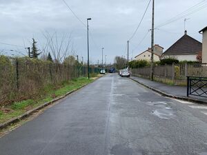
Rue Laënnec الإنجليزية (Q5263043)
شارع في فرنسا
| اللغة | التسمية | الوصف | أسماء أخرى |
|---|---|---|---|
| العربية | لم تُضف التسمية |
شارع في فرنسا |
|
| الإنجليزية | Rue Laënnec |
street in Gagny, France |
بيانات
Wikidata item الإنجليزية
instance of الإنجليزية
country الإنجليزية
OpenStreetMap relation ID الإنجليزية
part of الإنجليزية
Commons category الإنجليزية
place name sign الإنجليزية
Plaque Rue Laënnec - Gagny (FR93) - 2021-04-10 - 1.jpg
٣٬٤٨٧ × ٢٬٠٧٣؛ ١٫٤٧ ميجابايت
٣٬٤٨٧ × ٢٬٠٧٣؛ ١٫٤٧ ميجابايت
١ مراجع
Imported from Wikidata item الإنجليزية
image الإنجليزية
Rue Laënnec - Gagny (FR93) - 2021-04-10 - 1.jpg
٤٬٠٣٢ × ٣٬٠٢٤؛ ٤٫١١ ميجابايت
٤٬٠٣٢ × ٣٬٠٢٤؛ ٤٫١١ ميجابايت
١ مراجع
Imported from Wikidata item الإنجليزية
coordinate location الإنجليزية
named after الإنجليزية
shares border with الإنجليزية
Rue George-Sand الإنجليزية
coordinate location الإنجليزية
48°52'34.547"N, 2°33'22.540"E
١ مراجع
Imported from Wikidata item الإنجليزية
Quai du Chenay الإنجليزية
coordinate location الإنجليزية
48°52'32.974"N, 2°33'44.881"E
١ مراجع
Imported from Wikidata item الإنجليزية
Avenue Louis-Lumière الإنجليزية
coordinate location الإنجليزية
48°52'32.974"N, 2°33'44.881"E
١ مراجع
Imported from Wikidata item الإنجليزية
Rue Marcelin-Berthelot الإنجليزية
coordinate location الإنجليزية
48°52'34.352"N, 2°33'34.596"E
١ مراجع
Imported from Wikidata item الإنجليزية
Rue Jean-Stephan الإنجليزية
coordinate location الإنجليزية
48°52'33.874"N, 2°33'40.525"E
١ مراجع
Imported from Wikidata item الإنجليزية
Rue du Chemin-de-Fer الإنجليزية
coordinate location الإنجليزية
48°52'34.543"N, 2°33'21.992"E
١ مراجع
Imported from Wikidata item الإنجليزية
Rue de Meaux الإنجليزية
coordinate location الإنجليزية
48°52'34.543"N, 2°33'21.992"E
١ مراجع
Imported from Wikidata item الإنجليزية

