avenue du Bout-de-la-Ville الإنجليزية (Q5334256)
avenue in Rungis, France الإنجليزية
| اللغة | التسمية | الوصف | أسماء أخرى |
|---|---|---|---|
| العربية | لم تُضف التسمية |
لا يوجد وصف |
|
| الإنجليزية | avenue du Bout-de-la-Ville |
avenue in Rungis, France |
بيانات
Wikidata item الإنجليزية
instance of الإنجليزية
country الإنجليزية
OpenStreetMap relation ID الإنجليزية
part of الإنجليزية
coordinate location الإنجليزية
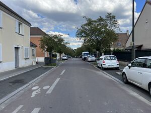
image الإنجليزية
Avenue Bout Ville - Rungis (FR94) - 2022-05-30 - 1.jpg
٤٬٠٣٢ × ٣٬٠٢٤؛ ٤٫١٨ ميجابايت
٤٬٠٣٢ × ٣٬٠٢٤؛ ٤٫١٨ ميجابايت
١ مراجع
Imported from Wikidata item الإنجليزية
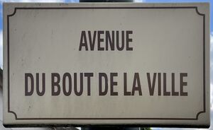
place name sign الإنجليزية
Plaque Avenue Bout Ville - Rungis (FR94) - 2022-05-30 - 1.jpg
٣٬٥٠١ × ٢٬١٤٤؛ ١٫٤٨ ميجابايت
٣٬٥٠١ × ٢٬١٤٤؛ ١٫٤٨ ميجابايت
١ مراجع
Imported from Wikidata item الإنجليزية
Commons category الإنجليزية
shares border with الإنجليزية
place de l'Aqueduc Antique الإنجليزية
coordinate location الإنجليزية
48°44'46.234"N, 2°20'45.888"E
١ مراجع
Imported from Wikidata item الإنجليزية
allée des Septiers الإنجليزية
coordinate location الإنجليزية
48°44'46.234"N, 2°20'45.888"E
١ مراجع
Imported from Wikidata item الإنجليزية
allée des Grisonnières الإنجليزية
coordinate location الإنجليزية
48°44'47.267"N, 2°20'42.850"E
١ مراجع
Imported from Wikidata item الإنجليزية
allée de la Pierrée الإنجليزية
coordinate location الإنجليزية
48°44'45.661"N, 2°20'47.544"E
١ مراجع
Imported from Wikidata item الإنجليزية
chemin de Paray الإنجليزية
coordinate location الإنجليزية
48°44'44.930"N, 2°20'51.270"E
١ مراجع
Imported from Wikidata item الإنجليزية
allée du Grat-Coq الإنجليزية
coordinate location الإنجليزية
48°44'46.874"N, 2°20'44.016"E
١ مراجع
Imported from Wikidata item الإنجليزية
allée de l'Aulnaie des Maillets الإنجليزية
coordinate location الإنجليزية
48°44'46.846"N, 2°20'44.095"E
١ مراجع
Imported from Wikidata item الإنجليزية
allée du Rû de Rungis الإنجليزية
coordinate location الإنجليزية
48°44'45.110"N, 2°20'49.693"E
١ مراجع
Imported from Wikidata item الإنجليزية

