rue David-d'Angers الإنجليزية (Q3737459)
street in Paris, France الإنجليزية
| اللغة | التسمية | الوصف | أسماء أخرى |
|---|---|---|---|
| العربية | لم تُضف التسمية |
لا يوجد وصف |
|
| الإنجليزية | rue David-d'Angers |
street in Paris, France |
بيانات
Wikidata item الإنجليزية
instance of الإنجليزية
image الإنجليزية
Paris rue david-d'angers.jpg
١٬٠٩٤ × ٨٢١؛ ٢٤٨ كيلوبايت
١٬٠٩٤ × ٨٢١؛ ٢٤٨ كيلوبايت
١ مراجع
Imported from Wikidata item الإنجليزية
coordinate location الإنجليزية
shares border with الإنجليزية
avenue Debidour الإنجليزية
coordinate location الإنجليزية
48°52'52.7"N, 2°23'48.1"E
١ مراجع
Imported from Wikidata item الإنجليزية
boulevard Sérurier الإنجليزية
coordinate location الإنجليزية
48°52'52.7"N, 2°23'48.1"E
١ مراجع
Imported from Wikidata item الإنجليزية
place Rhin-et-Danube الإنجليزية
coordinate location الإنجليزية
48°52'55.6"N, 2°23'34.4"E
48°52'55.2"N, 2°23'35.9"E
١ مراجع
Imported from Wikidata item الإنجليزية
rue de la Fraternité الإنجليزية
coordinate location الإنجليزية
48°52'54.8"N, 2°23'36.6"E
١ مراجع
Imported from Wikidata item الإنجليزية
rue de la Prévoyance الإنجليزية
coordinate location الإنجليزية
48°52'56.6"N, 2°23'28.3"E
١ مراجع
Imported from Wikidata item الإنجليزية
rue de la Solidarité الإنجليزية
coordinate location الإنجليزية
48°52'58.1"N, 2°23'21.8"E
١ مراجع
Imported from Wikidata item الإنجليزية
rue d'Hautpoul الإنجليزية
coordinate location الإنجليزية
48°52'59.5"N, 2°23'16.4"E
١ مراجع
Imported from Wikidata item الإنجليزية
rue François-Pinton الإنجليزية
coordinate location الإنجليزية
48°52'57.4"N, 2°23'25.4"E
١ مراجع
Imported from Wikidata item الإنجليزية
rue Gaston-Pinot الإنجليزية
coordinate location الإنجليزية
48°52'57.7"N, 2°23'24.0"E
١ مراجع
Imported from Wikidata item الإنجليزية
rue Manin الإنجليزية
coordinate location الإنجليزية
48°52'59.5"N, 2°23'16.4"E
١ مراجع
Imported from Wikidata item الإنجليزية
villa des Aigrettes الإنجليزية
coordinate location الإنجليزية
48°52'57.0"N, 2°23'28.0"E
١ مراجع
Imported from Wikidata item الإنجليزية
villa des Sizerins الإنجليزية
coordinate location الإنجليزية
48°52'57.0"N, 2°23'26.9"E
١ مراجع
Imported from Wikidata item الإنجليزية
villa du Danube الإنجليزية
coordinate location الإنجليزية
48°52'53.8"N, 2°23'42.4"E
١ مراجع
Imported from Wikidata item الإنجليزية
villa Alexandre-Ribot الإنجليزية
coordinate location الإنجليزية
48°52'53.396"N, 2°23'43.714"E
١ مراجع
Imported from Wikidata item الإنجليزية
country الإنجليزية
length الإنجليزية
width الإنجليزية
named after الإنجليزية
Commons category الإنجليزية
Google Knowledge Graph ID الإنجليزية
part of الإنجليزية
place name sign الإنجليزية
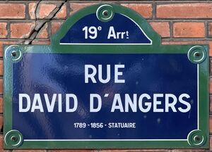
Plaque Rue David Angers - Paris XIX (FR75) - 2021-07-22 - 1.jpg
٣٬٤٤٢ × ٢٬٤٧٦؛ ٢٫٠٥ ميجابايت
٣٬٤٤٢ × ٢٬٤٧٦؛ ٢٫٠٥ ميجابايت
language of work or name الإنجليزية
١ مراجع
Imported from Wikidata item الإنجليزية
official name الإنجليزية
rue David d'Angers (الفرنسية)
start time الإنجليزية
١٠ نوفمبر 1877http://data.marefa.org/entity/Q1985727
١ مراجع
Imported from Wikidata item الإنجليزية

