Rue Kléber الإنجليزية (Q4231482)
street of Montreuil, Seine-Saint-Denis, France الإنجليزية
| اللغة | التسمية | الوصف | أسماء أخرى |
|---|---|---|---|
| العربية | لم تُضف التسمية |
لا يوجد وصف |
|
| الإنجليزية | Rue Kléber |
street of Montreuil, Seine-Saint-Denis, France |
بيانات
Wikidata item الإنجليزية
OpenStreetMap relation ID الإنجليزية
instance of الإنجليزية
country الإنجليزية
coordinate location الإنجليزية
official name الإنجليزية
Commons category الإنجليزية
named after الإنجليزية
place name sign الإنجليزية
Plaque Rue Kléber - Montreuil (FR93) - 2020-10-21 - 2.jpg
٢٬٩٤٩ × ١٬٨٨٢؛ ١٫٤٢ ميجابايت
٢٬٩٤٩ × ١٬٨٨٢؛ ١٫٤٢ ميجابايت
١ مراجع
Imported from Wikidata item الإنجليزية
image الإنجليزية
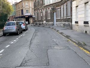
Rue Kléber - Montreuil (FR93) - 2020-10-21 - 2.jpg
٤٬٠٣٢ × ٣٬٠٢٤؛ ٤٫٧١ ميجابايت
٤٬٠٣٢ × ٣٬٠٢٤؛ ٤٫٧١ ميجابايت
١ مراجع
Imported from Wikidata item الإنجليزية
part of الإنجليزية
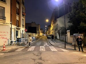
nighttime view الإنجليزية
Rue Kléber - Montreuil (FR93) - 2022-02-08 - 2.jpg
٤٬٠٣٢ × ٣٬٠٢٤؛ ٣٫٨٢ ميجابايت
٤٬٠٣٢ × ٣٬٠٢٤؛ ٣٫٨٢ ميجابايت
١ مراجع
Imported from Wikidata item الإنجليزية
shares border with الإنجليزية
Rue des Fédérés الإنجليزية
coordinate location الإنجليزية
48°51'6.300"N, 2°26'1.493"E
١ مراجع
Imported from Wikidata item الإنجليزية
Rue Michelet الإنجليزية
coordinate location الإنجليزية
48°51'9.061"N, 2°26'2.213"E
١ مراجع
Imported from Wikidata item الإنجليزية
Rue Douy-Delcupe الإنجليزية
coordinate location الإنجليزية
48°51'17.741"N, 2°26'5.626"E
١ مراجع
Imported from Wikidata item الإنجليزية
Avenue Paul-Langevin الإنجليزية
coordinate location الإنجليزية
48°51'28.339"N, 2°26'12.851"E
١ مراجع
Imported from Wikidata item الإنجليزية
Place Jacques-Duclos الإنجليزية
coordinate location الإنجليزية
48°51'28.339"N, 2°26'12.851"E
١ مراجع
Imported from Wikidata item الإنجليزية
Rue Girard الإنجليزية
coordinate location الإنجليزية
48°51'25.888"N, 2°26'11.278"E
١ مراجع
Imported from Wikidata item الإنجليزية
Rue Marcelin-Berthelot الإنجليزية
coordinate location الإنجليزية
48°51'24.113"N, 2°26'10.439"E
١ مراجع
Imported from Wikidata item الإنجليزية
Rue du Sergent-Godefroy الإنجليزية
coordinate location الإنجليزية
48°51'12.787"N, 2°26'3.070"E
١ مراجع
Imported from Wikidata item الإنجليزية


