Route des Planons الإنجليزية (Q4982377)
street in Saint-Cyr-sur-Menthon, France الإنجليزية
| اللغة | التسمية | الوصف | أسماء أخرى |
|---|---|---|---|
| العربية | لم تُضف التسمية |
لا يوجد وصف |
|
| الإنجليزية | Route des Planons |
street in Saint-Cyr-sur-Menthon, France |
بيانات
Wikidata item الإنجليزية
Commons category الإنجليزية
instance of الإنجليزية
country الإنجليزية
OpenStreetMap relation ID الإنجليزية
coordinate location الإنجليزية
named after الإنجليزية
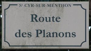
place name sign الإنجليزية
Plaque route Planons St Cyr Menthon 5.jpg
٤٬٠١٣ × ٢٬٢٨٩؛ ٣٫٠١ ميجابايت
٤٬٠١٣ × ٢٬٢٨٩؛ ٣٫٠١ ميجابايت
language of work or name الإنجليزية
١ مراجع
Imported from Wikidata item الإنجليزية
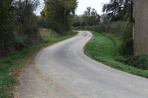
image الإنجليزية
Route Planons St Cyr Menthon 1.jpg
٥٬١٨٤ × ٣٬٤٥٦؛ ٧٫٤ ميجابايت
٥٬١٨٤ × ٣٬٤٥٦؛ ٧٫٤ ميجابايت
١ مراجع
Imported from Wikidata item الإنجليزية
part of الإنجليزية
official name الإنجليزية
shares border with الإنجليزية
route de Loëze الإنجليزية
coordinate location الإنجليزية
46°17'19.856"N, 4°58'25.802"E
١ مراجع
Imported from Wikidata item الإنجليزية
route de Bergemot الإنجليزية
coordinate location الإنجليزية
46°17'19.856"N, 4°58'25.802"E
١ مراجع
Imported from Wikidata item الإنجليزية
Route de la Mulatière الإنجليزية
coordinate location الإنجليزية
46°17'5.572"N, 4°59'0.773"E
١ مراجع
Imported from Wikidata item الإنجليزية
chemin des Seiglières الإنجليزية
coordinate location الإنجليزية
46°17'2.659"N, 4°59'7.958"E
١ مراجع
Imported from Wikidata item الإنجليزية
Route de Saint-Genis الإنجليزية
coordinate location الإنجليزية
46°17'2.659"N, 4°59'7.958"E
١ مراجع
Imported from Wikidata item الإنجليزية
Route des Merlières الإنجليزية
coordinate location الإنجليزية
46°17'17.624"N, 4°58'42.503"E
١ مراجع
Imported from Wikidata item الإنجليزية
Sentier des Bouquins الإنجليزية
coordinate location الإنجليزية
46°17'9.265"N, 4°58'54.656"E
١ مراجع
Imported from Wikidata item الإنجليزية
chemin Terre de Vent الإنجليزية
coordinate location الإنجليزية
46°17'5.561"N, 4°59'0.920"E
١ مراجع
Imported from Wikidata item الإنجليزية

