route de Bâgé الإنجليزية (Q5373759)
street in Saint-Cyr-sur-Menthon, France الإنجليزية
| اللغة | التسمية | الوصف | أسماء أخرى |
|---|---|---|---|
| العربية | لم تُضف التسمية |
لا يوجد وصف |
|
| الإنجليزية | route de Bâgé |
street in Saint-Cyr-sur-Menthon, France |
|
بيانات
Wikidata item الإنجليزية
Commons category الإنجليزية
OpenStreetMap relation ID الإنجليزية
coordinate location الإنجليزية
country الإنجليزية
instance of الإنجليزية
named after الإنجليزية
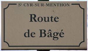
place name sign الإنجليزية
Plaque route Bâgé St Cyr Menthon 1.jpg
٤٬٥٨٣ × ٢٬٦٥٦؛ ٣٫٧٨ ميجابايت
٤٬٥٨٣ × ٢٬٦٥٦؛ ٣٫٧٨ ميجابايت
language of work or name الإنجليزية
١ مراجع
Imported from Wikidata item الإنجليزية
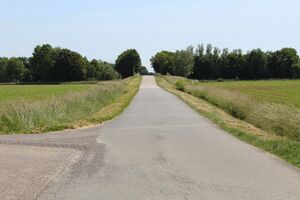
image الإنجليزية
Route Bâgé St Cyr Menthon 6.jpg
٥٬١٨٤ × ٣٬٤٥٦؛ ٦٫٨٣ ميجابايت
٥٬١٨٤ × ٣٬٤٥٦؛ ٦٫٨٣ ميجابايت
١ مراجع
Imported from Wikidata item الإنجليزية
part of الإنجليزية
official name الإنجليزية
shares border with الإنجليزية
Route de Mâcon الإنجليزية
coordinate location الإنجليزية
46°16'39.925"N, 4°57'20.153"E
١ مراجع
Imported from Wikidata item الإنجليزية
route de Vonnas الإنجليزية
coordinate location الإنجليزية
46°16'39.925"N, 4°57'20.153"E
١ مراجع
Imported from Wikidata item الإنجليزية
route de la Tuilerie الإنجليزية
coordinate location الإنجليزية
46°16'47.107"N, 4°57'24.761"E
١ مراجع
Imported from Wikidata item الإنجليزية
route des Verchères الإنجليزية
coordinate location الإنجليزية
46°17'7.321"N, 4°57'31.140"E
١ مراجع
Imported from Wikidata item الإنجليزية
route de Gréziat الإنجليزية
coordinate location الإنجليزية
46°17'9.776"N, 4°57'26.712"E
١ مراجع
Imported from Wikidata item الإنجليزية
Route de Cormorey الإنجليزية
coordinate location الإنجليزية
46°17'18.323"N, 4°57'30.208"E
١ مراجع
Imported from Wikidata item الإنجليزية
route de Bergemot الإنجليزية
coordinate location الإنجليزية
46°17'23.248"N, 4°57'26.262"E
١ مراجع
Imported from Wikidata item الإنجليزية
Chemin du Pavillon الإنجليزية
coordinate location الإنجليزية
46°17'23.248"N, 4°57'26.262"E
١ مراجع
Imported from Wikidata item الإنجليزية
sentier de Branguemouille الإنجليزية
coordinate location الإنجليزية
46°17'34.537"N, 4°57'1.192"E
١ مراجع
Imported from Wikidata item الإنجليزية
Route de Montépin الإنجليزية
coordinate location الإنجليزية
46°17'34.537"N, 4°57'1.192"E
١ مراجع
Imported from Wikidata item الإنجليزية

