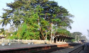
Parappanangadi Municipality الإنجليزية (Q3602466)
مستوطنة في الهند
| اللغة | التسمية | الوصف | أسماء أخرى |
|---|---|---|---|
| العربية | لم تُضف التسمية |
مستوطنة في الهند |
|
| الإنجليزية | Parappanangadi Municipality |
municipality in Malappuram district of Kerala, India |
|
بيانات
Wikidata item الإنجليزية
coordinate location الإنجليزية
11°3'0.86"N, 75°51'56.92"E
applies to part الإنجليزية
١ مراجع
Imported from Wikidata item الإنجليزية
instance of الإنجليزية
country الإنجليزية
image الإنجليزية
Commons category الإنجليزية
postal code الإنجليزية
local dialing code الإنجليزية
located in time zone الإنجليزية
area الإنجليزية
٢٣٫٤٩ كيلومتر مربع
point in time الإنجليزية
2019http://data.marefa.org/entity/Q1985727
determination method الإنجليزية
cartographic generalization الإنجليزية
١ مراجع
Imported from Wikidata item الإنجليزية
official website الإنجليزية
١ مراجع
Imported from Wikidata item الإنجليزية
part of الإنجليزية
OpenStreetMap relation ID الإنجليزية
coordinates of southernmost point الإنجليزية
coordinates of northernmost point الإنجليزية
coordinates of westernmost point الإنجليزية
coordinates of easternmost point الإنجليزية
coordinates of geographic center الإنجليزية
11°2'59.03"N, 75°52'1.34"E
determination method الإنجليزية
١ مراجع
Imported from Wikidata item الإنجليزية
11°3'12.82"N, 75°52'3.25"E
determination method الإنجليزية
١ مراجع
Imported from Wikidata item الإنجليزية
perimeter الإنجليزية
٢٦٫٢١ كيلومتر
point in time الإنجليزية
2019http://data.marefa.org/entity/Q1985727
determination method الإنجليزية
١ مراجع
Imported from Wikidata item الإنجليزية
Freebase ID الإنجليزية
associated electoral district الإنجليزية
