Fasoula, Limassol الإنجليزية (Q485137)
community in Limassol District, Republic of Cyprus الإنجليزية
| اللغة | التسمية | الوصف | أسماء أخرى |
|---|---|---|---|
| العربية | لم تُضف التسمية |
لا يوجد وصف |
|
| الإنجليزية | Fasoula, Limassol |
community in Limassol District, Republic of Cyprus |
بيانات
Wikidata item الإنجليزية
coordinate location الإنجليزية
located in time zone الإنجليزية
postal code الإنجليزية
executive body الإنجليزية
office held by head of government الإنجليزية
١ مراجع
Imported from Wikidata item الإنجليزية
Commons category الإنجليزية
shares border with الإنجليزية
Ayios Athanasios الإنجليزية
direction relative to location الإنجليزية
١ مراجع
Imported from Wikidata item الإنجليزية
Mesa Geitonia الإنجليزية
direction relative to location الإنجليزية
١ مراجع
Imported from Wikidata item الإنجليزية
Palodia الإنجليزية
direction relative to location الإنجليزية
١ مراجع
Imported from Wikidata item الإنجليزية
Spitali الإنجليزية
direction relative to location الإنجليزية
١ مراجع
Imported from Wikidata item الإنجليزية
Apsiou الإنجليزية
direction relative to location الإنجليزية
١ مراجع
Imported from Wikidata item الإنجليزية
Mathikoloni الإنجليزية
direction relative to location الإنجليزية
١ مراجع
Imported from Wikidata item الإنجليزية
official name الإنجليزية
native label الإنجليزية
head of government الإنجليزية
Giorgos Charalampous الإنجليزية
start time الإنجليزية
١ يناير 2017http://data.marefa.org/entity/Q1985727
١ مراجع
Imported from Wikidata item الإنجليزية
official website الإنجليزية
١ مراجع
Imported from Wikidata item الإنجليزية
١ مراجع
Imported from Wikidata item الإنجليزية
population الإنجليزية
١٩٠
point in time الإنجليزية
1881http://data.marefa.org/entity/Q1985727
male population الإنجليزية
١٠٢
female population الإنجليزية
٨٨
determination method الإنجليزية
١ مراجع
Imported from Wikidata item الإنجليزية
٢٥١
point in time الإنجليزية
1891http://data.marefa.org/entity/Q1985727
male population الإنجليزية
١٢٧
female population الإنجليزية
١٢٤
determination method الإنجليزية
١ مراجع
Imported from Wikidata item الإنجليزية
٢٦٢
point in time الإنجليزية
1901http://data.marefa.org/entity/Q1985727
male population الإنجليزية
١٣٠
female population الإنجليزية
١٣٢
determination method الإنجليزية
١ مراجع
Imported from Wikidata item الإنجليزية
٣٥٤
point in time الإنجليزية
1911http://data.marefa.org/entity/Q1985727
male population الإنجليزية
١٨٠
female population الإنجليزية
١٧٤
determination method الإنجليزية
١ مراجع
Imported from Wikidata item الإنجليزية
٤٤٢
point in time الإنجليزية
1921http://data.marefa.org/entity/Q1985727
male population الإنجليزية
٢٢٠
female population الإنجليزية
٢٢٢
determination method الإنجليزية
١ مراجع
Imported from Wikidata item الإنجليزية
٤٤٠
point in time الإنجليزية
1931http://data.marefa.org/entity/Q1985727
male population الإنجليزية
٢١٧
female population الإنجليزية
٢٢٣
determination method الإنجليزية
١ مراجع
Imported from Wikidata item الإنجليزية
٥٢٣
point in time الإنجليزية
1946http://data.marefa.org/entity/Q1985727
determination method الإنجليزية
١ مراجع
Imported from Wikidata item الإنجليزية
٤٣٥
point in time الإنجليزية
1960http://data.marefa.org/entity/Q1985727
male population الإنجليزية
٢١٩
female population الإنجليزية
٢١٦
determination method الإنجليزية
١ مراجع
Imported from Wikidata item الإنجليزية
٣٢٧
point in time الإنجليزية
1976http://data.marefa.org/entity/Q1985727
male population الإنجليزية
١٦٥
female population الإنجليزية
١٦٢
determination method الإنجليزية
١ مراجع
Imported from Wikidata item الإنجليزية
٣١٩
point in time الإنجليزية
1982http://data.marefa.org/entity/Q1985727
male population الإنجليزية
١٦٢
female population الإنجليزية
١٥٧
determination method الإنجليزية
١ مراجع
Imported from Wikidata item الإنجليزية
٣٢٧
point in time الإنجليزية
1992http://data.marefa.org/entity/Q1985727
male population الإنجليزية
١٥٩
female population الإنجليزية
١٦٨
determination method الإنجليزية
١ مراجع
Imported from Wikidata item الإنجليزية
٣٢٧
point in time الإنجليزية
2001http://data.marefa.org/entity/Q1985727
determination method الإنجليزية
male population الإنجليزية
١٥٠
female population الإنجليزية
١٧٧
١ مراجع
Imported from Wikidata item الإنجليزية
٥٦٠
point in time الإنجليزية
2011http://data.marefa.org/entity/Q1985727
male population الإنجليزية
٢٦١
female population الإنجليزية
٢٩٩
determination method الإنجليزية
١ مراجع
Imported from Wikidata item الإنجليزية
٣٢٥
determination method الإنجليزية
male population الإنجليزية
١٦٢
female population الإنجليزية
١٦٣
point in time الإنجليزية
1973http://data.marefa.org/entity/Q1985727
١ مراجع
Imported from Wikidata item الإنجليزية
area الإنجليزية
elevation above sea level الإنجليزية
coordinates of northernmost point الإنجليزية
coordinates of southernmost point الإنجليزية
coordinates of westernmost point الإنجليزية
coordinates of easternmost point الإنجليزية
VIAF ID الإنجليزية
country الإنجليزية
instance of الإنجليزية
part of الإنجليزية
member of الإنجليزية
Freebase ID الإنجليزية
different from الإنجليزية
locator map image الإنجليزية
LimassolDistrictFasoula, Limassol.png
١٬٨٧٣ × ١٬٤٢٣؛ ١٢٨ كيلوبايت
١٬٨٧٣ × ١٬٤٢٣؛ ١٢٨ كيلوبايت
media legend الإنجليزية
Η τοποθεσία της Φασούλας στην Επαρχία Λεμεσού. (اليونانية)
١ مراجع
Imported from Wikidata item الإنجليزية
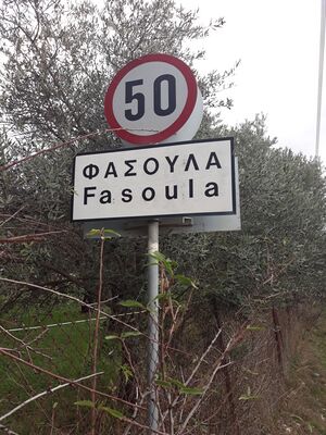
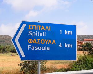
place name sign الإنجليزية
Fasoula, Limassol, Road Sign.jpg
٣٬٠٩٦ × ٤٬١٢٨؛ ٦٫٧١ ميجابايت
٣٬٠٩٦ × ٤٬١٢٨؛ ٦٫٧١ ميجابايت
١ مراجع
Imported from Wikidata item الإنجليزية
Fasoula, Limassol Road Sign.jpg
٢٬٩٩٧ × ٢٬٣٩٨؛ ٢٫٤٦ ميجابايت
٢٬٩٩٧ × ٢٬٣٩٨؛ ٢٫٤٦ ميجابايت
١ مراجع
Imported from Wikidata item الإنجليزية
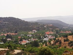
image الإنجليزية
View of Fasoula, Limassol 02.jpg
٤٬١٢٨ × ٣٬٠٩٦؛ ٢٫٦٥ ميجابايت
٤٬١٢٨ × ٣٬٠٩٦؛ ٢٫٦٥ ميجابايت
media legend الإنجليزية
Πανοραμική άποψη Φασούλας. (اليونانية)
Panoramic view of Fasoula. (الإنجليزية)
١ مراجع
Imported from Wikidata item الإنجليزية
Facebook ID الإنجليزية
وصلات الموقع
Marefa(٠ : لا وصلات)
ويكيبيديا(٣ وصلات)
- dewiki Fasoula (Bezirk Limassol)
- enwiki Fasoula, Limassol
- frwiki Fasoúla


