Luton الإنجليزية (Q513505)
district in Bedfordshire, England الإنجليزية
| اللغة | التسمية | الوصف | أسماء أخرى |
|---|---|---|---|
| العربية | لم تُضف التسمية |
لا يوجد وصف |
|
| الإنجليزية | Luton |
district in Bedfordshire, England |
|
بيانات
Wikidata item الإنجليزية
instance of الإنجليزية
county borough الإنجليزية
end time الإنجليزية
1974http://data.marefa.org/entity/Q1985727
١ مراجع
Imported from Wikidata item الإنجليزية
municipal borough الإنجليزية
end time الإنجليزية
1964http://data.marefa.org/entity/Q1985727
١ مراجع
Imported from Wikidata item الإنجليزية
country الإنجليزية
population الإنجليزية
٢١٤٬٧٠٠
determination method الإنجليزية
point in time الإنجليزية
2015http://data.marefa.org/entity/Q1985727
١ مراجع
Imported from Wikidata item الإنجليزية
٢١٤٬١٠٩
point in time الإنجليزية
2018http://data.marefa.org/entity/Q1985727
determination method الإنجليزية
١ مراجع
Imported from Wikidata item الإنجليزية
٢٠٥٬٨٠٠
point in time الإنجليزية
2012http://data.marefa.org/entity/Q1985727
determination method الإنجليزية
١ مراجع
Imported from Wikidata item الإنجليزية
٢٢٦٬٩٧٣
point in time الإنجليزية
2022http://data.marefa.org/entity/Q1985727
determination method الإنجليزية
١ مراجع
Imported from Wikidata item الإنجليزية
ISO 3166-2 code الإنجليزية
coordinate location الإنجليزية
Encyclopædia Britannica Online ID الإنجليزية
legislative body الإنجليزية
area الإنجليزية
٤٣٫٣٥٢٥ كيلومتر مربع
point in time الإنجليزية
2016http://data.marefa.org/entity/Q1985727
١ مراجع
Imported from Wikidata item الإنجليزية
VIAF ID الإنجليزية
OpenStreetMap relation ID الإنجليزية
Commons category الإنجليزية
topic's main category الإنجليزية
image الإنجليزية
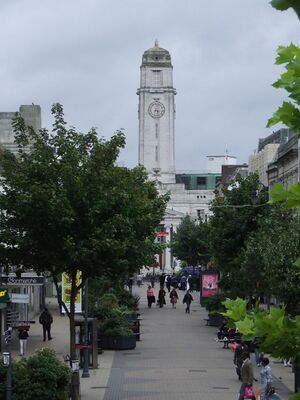
Luton Town Hall - geograph.org.uk - 944904.jpg
٤٨٠ × ٦٤٠؛ ٩٧ كيلوبايت
٤٨٠ × ٦٤٠؛ ٩٧ كيلوبايت
media legend الإنجليزية
Radnice v Lutonu (التشيكية)
١ مراجع
Imported from Wikidata item الإنجليزية
inception الإنجليزية
